About Dooars
The Dooars beckons to all those who love nature and wishes to explore and experience its virgin beauty and bounty. Meandering and innumerable streams,rivulets and rivers with the hills as background make this plain land home of wildlife and tea estate. Its irresistible range of high hills and lofty mountains with virgin trekking routes, magnificent verdant forests and rich wildlife is awe inspiring. Dooars lush green tea gardens and its pluralized society enriched by many tribes and indigenous people are just too tempting to be missed out on.The cultural diversities, is unparalleled as more than 20 tribes are settled in this region. Mecheni dance, Bhawaiya folk music and Rava dance are some of the distinct elements which have gained national and international fame and can be found or heard here. The peaceful and harmonious co - existence of Toto’s, Santhal, Rava, Kotch, Oraon, Mech, Dukpas, Bhutanese and Nepalese, is what makes this part of India a unique destination. Inhabiting together and making a perfect mosaic reflects unity in diversity.
Buxa Tiger Reserve
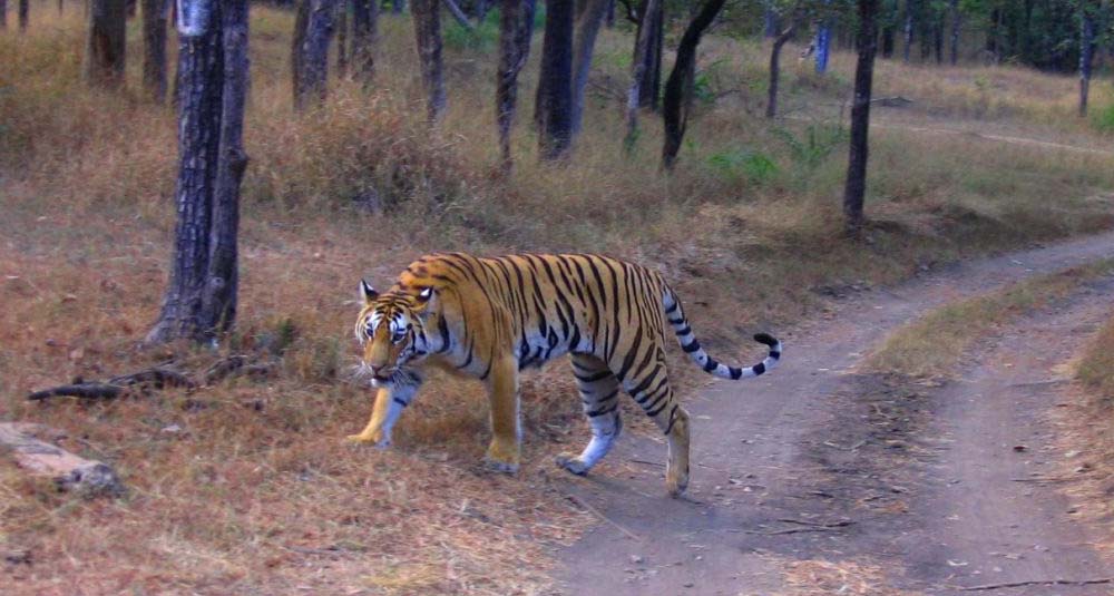
Once famous for dolomite mining, Buxa was declared a tiger reserve in 1983 and got the status of National park in 1992. Located in the Assam-Bhutan border, Buxa has an area of 745 sq km, the largest forest in North Bengal and has the second highest tiger population in West Bengal after Sunderbans. The park holds maximum number of elephant, Indian bison, leopard, many species of deer and many smaller mammals, innumerable species of birds and reptiles. Buxa is rich with bio-diversity and has a great collection of rare orchids and medicinal plants. Because of inaccessible terrain, some parts of Buxa hills in the Sinchula range are still unexplored. Buxa is one of the oldest settlements in North Bengal. It is 24kms from Alipurduar and 180 km from Siliguri, well connected by both motorable road and railways. Several trek routes originate here.
Chapramari
Chapramari forests is essentially a continuation of the Gorumara National Park. The two forests are divided by the Murti River. The North East side of the river is Chapramari Wild Life Sanctuary whereas the South West side is where Gorumara is located.
If you are travelling through Dooars via National Highway 31, the forests you see on both sides of the road between Chalsa and Nagrakata is part of Chapramari WLS. The forest is relatively small in size but is one of the oldest in India. It was declared a reserve forest back in 1895. The West side of the river is bounded by River Murti and on the Eastern side by river Jaldhaka. The total area of the forest is about 10 square km.
In the recent past, the area has come up as an important tourist destination in Western Dooars.
Gorumara National Park
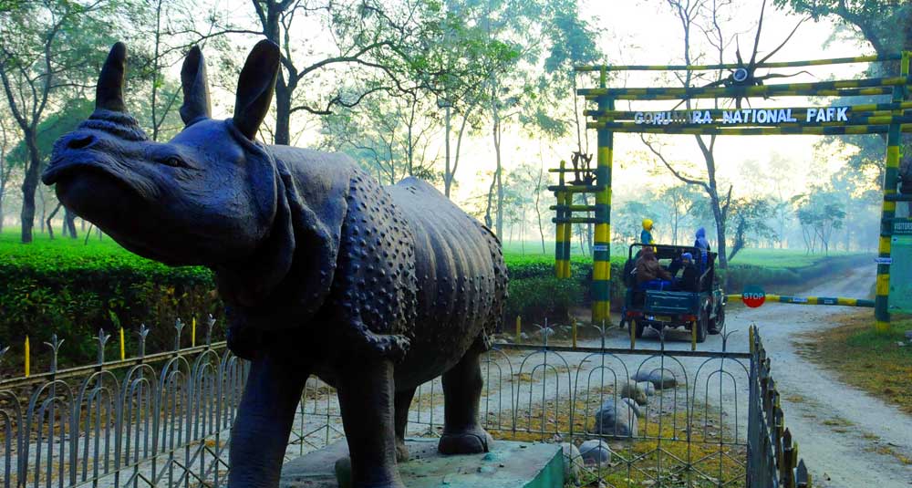
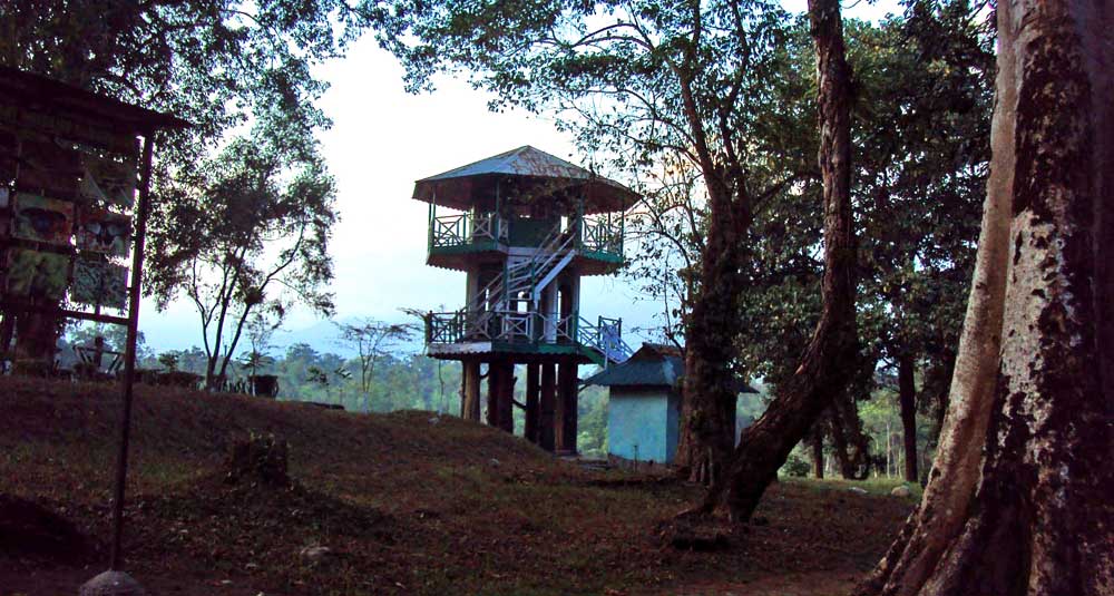
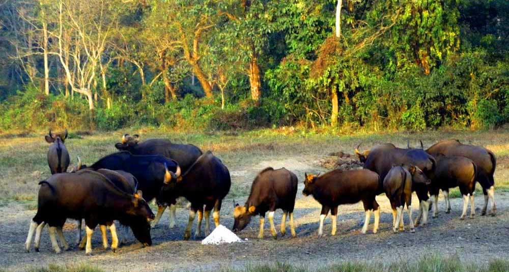
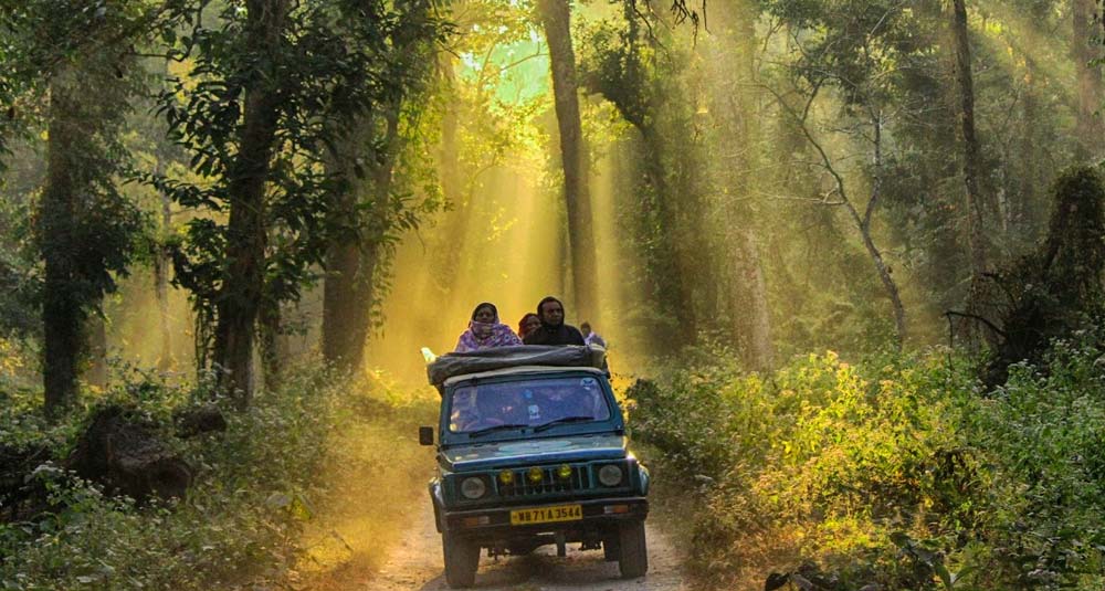
It was declared as a National Park in the year 1992. Earlier in the year 1949 it was known as a wildlife sanctuary, river Murti, Jaldhaka and Ingdong drains this park forming a water body known for birding. This national park is famous for the breeding of the rare one - horned rhinoceros. Elephant ride and Jeep safari can help you spot the mighty bison, leopard or spotted deer and peacocks. The other mammals found here are, sambar, hog deer, reptiles, huge wild tuskers, wild boars and the rarest variety of animals and birds. It is a paradise for lovers of nature and adventurer.
Jaldapara Wildlife Sanctuary
This is one of the most visited sites of Dooars and preferable time to visit is from September end to mid May. This is a bird watcher’s paradise. The rare Bengal Florican can be spotted here along with hornbill, racket - tailed drongo and paradise flycatcher. One can also find the rarest variety of animals and birds including peacocks. The Sanctuary remains closed during May 15th to September 15th. It is one of the oldest sanctuaries, established in 1941. It is similar to the savannah of South America with elephant grasses, interspersed with trees and bamboo. One - horned rhinoceros, an animal threatened with extinction ca be found here in abundance along with leopards, elephants, sambhar, barking deer, spotted deer, hog deer, and herds of wild boars and bison. Elephant safaris is one of the most sort after entertainment and even Jeep safaris are sometime missed by traveler.
Bindu
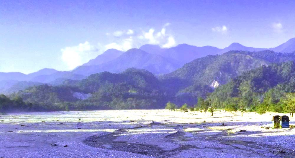
Bindu is only 107 km from Siliguri. The last hamlet of West Bengal, Bindu is a valley encircled with hills of Bhutan and India on the banks of river Jaldhaka. It is a feast for the eyes and a stimulating experience for the mind.
The road that leads to Bindu is in itself an unforgettable experience. The Dooars area starts immediately after you cross the Tista River at Coronation Bridge. The whole region is extremely beautiful with green vegetation all around. Most of the time you will be traveling through the plain with the hills on your left just a few hundred meters away. There is also the possibility of sighting wild life on the way. Bindu is a conglomeration of different aborigines. The peace loving people of Bindu are engaged either in Elaichi (Cardamom) or Suntala (Orange) cultivation. Terrace cultivation is quite common here.
Just a few kilometers away from Bindu and paren on an accentuated height is Godak village. On either side of the road, you will find Cardamom and Orange plantation. From here, you can have a view of the few villages of Bhutan, Paren and Bindu. On the way to Godak Government has set up a Cardamom Curing Centre for the farmers.
Lata Guri
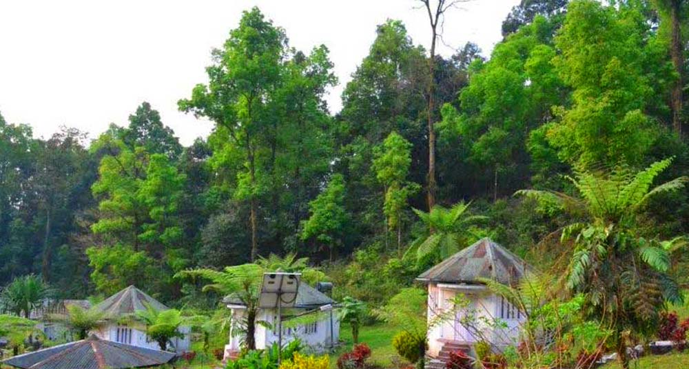
The small village is now a tourist town with several dozens of tourist lodges and resorts coming up in the town. Lataguri is bounded on the North and East by Gorumara forests, in the South Moulani more and in the West by Neora river. The main road crisscrossing the town South- North is the original National Highway 31. There is one road originating from this highway near Lataguri Welfare Association and moving east crossing the forest to reach Ramsai. Another road originates at Neora more and goes towards the West. This road crosses Neora river and to Malbazar. Most of the population in Lataguri are Bengali or Rajbanshis. Main economic activity till the 90’s was Saw mill, Timber merchant and goods transport. Today the economy is overwhelmingly dependent on tourism.
Samsing
At a distance of 82 km from Siliguri, it takes about 3 hours to reach Samsing from Siliguri through the most picturesque landscape. As you enter Dooars through the National Highway 31, you will cross Malbazar to reach Chalsa. From Chalsa take a left turn and drive on for 15 kms via Meteli to reach Samsing. The last few kilometres drive is a feast for the eyes as you pass through some of the most picturesque tea gardens of Dooars including the Chalsa Tea Garden, Zurantee Tea Garden and Samsing Tea Garden. The road is relatively narrow but there are few vehicles traveling through this route as the road ends at Samsing.
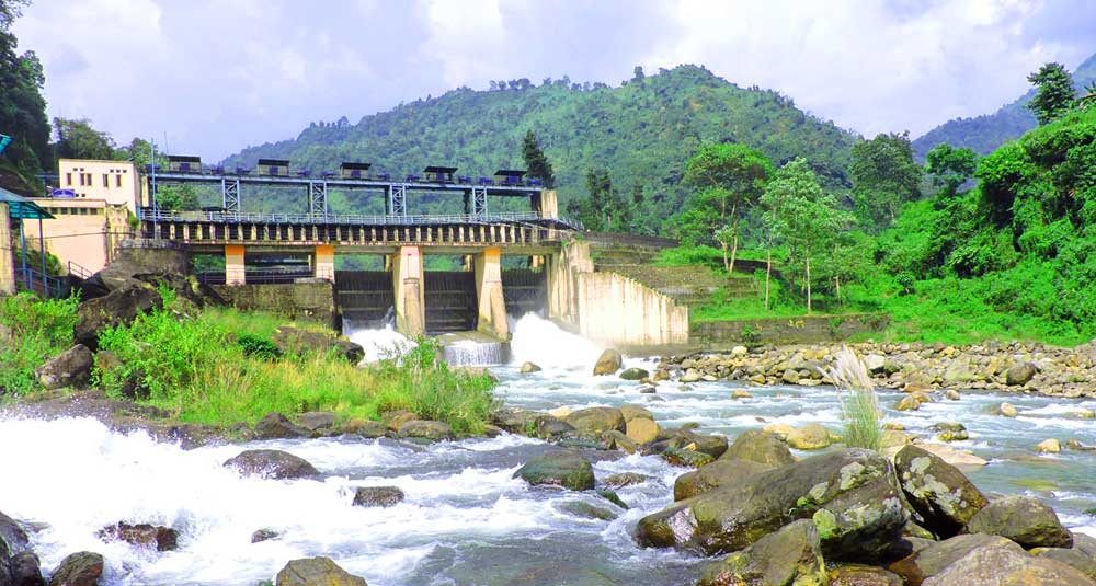
Gajoldoba
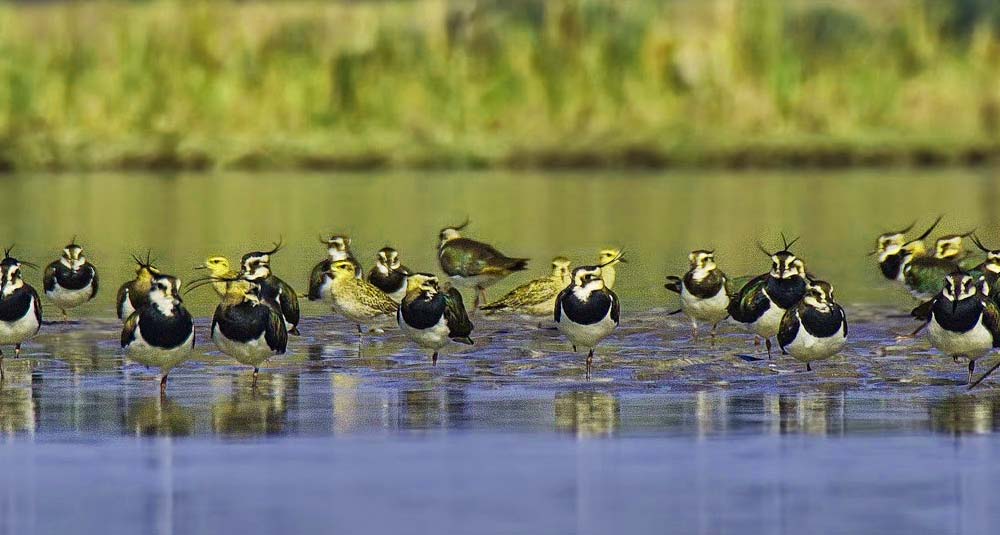
Gajoldoba is a reservoir formed by the first Teesta Barrage, which was built for irrigational purposes. It is surrounded by the Baikunthapur forests, and is an hour's drive from Jalpaiguri. The reservoir is used by many water birds from Ladakh and Central Asia – Little Grebe, Great Crested Grebe, Bar-headed Goose, Greylag Goose, Lesser Whistling Duck, Ruddy Shelduck, Common Shelduck, Cotton Teal, Tufted Duck, Common Teal, Eurasian Wigeon, Spot-billed Duck, Mallard, Great Cormorant, Indian Cormorant, Little Cormorant, Indian Pond Heron, Grey Heron, Purple Heron, Northern Lapwing, River Lapwing, Grey-headed Lapwing, Little Ringed Plover, etc.
Coochbehar
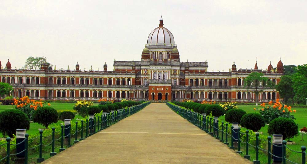
Coochbehar is one of the Easternmost towns of Dooars and a town with great historical significance. The place got its name from the Cooch dynasty which made this town its capital for more than 400 years. It became part of India at the time of India's Independence. Coochbehar is now a district of West Bengal. The centre of tourist attraction in the town is the Raj Palace. It was established by King Nripendra Narayan Bhup Bahadur in 1887. The huge palace is built in Indo-Saracenic Revival architecture combining British architectural style with Mughal style. The place is made of red bricks and is said to be inspired by Buckinghum palace. King Nripendra Narayan got his education at London. The palace is inspired by Italian renaissance. The original palace was 3 storied high but the third floor was destroyed during the great earthquake of 1897 measuring 8.7 in Richter scale. The building covers an area of 4,700 square meters. The Length of the palace is 120 meters North to South and the width East to West is 90 meters.
Jayanti
This small settlement is situated on the bank of River Jayanti. A spot with natural beauty forms a natural border with Bhutan. A 14 kilometer trek will take you to Buxa. Buxa is known as the Buxa Tiger Reserve. Another option is a short trek to the stalactite cave otherwise known as the Mahakal cave. Jayanti, Buxa and Rajabhatkhawa serves as international corridor for elephant migration between India and Bhutan. Jayanti forest range covers approximately around 780 square kilometers. Migratory birds like Goosanders, Ibis Bill, Fork-tails and many other species of birds visit the swift rivers of Rydak and Jayanti.